Mt Longonot National Park
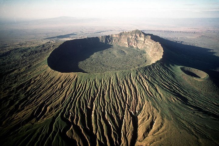
Hill climbers and view-seekers should not miss the opportunity to climb to the rim of dormant Longonot (2,886 metres), a fairly young volcano that still retains the typical shape of these mountains, although it is far from being a perfect cone.
As this is a national park, there is an entrance fee of US$50. The scramble up to the rim takes about 45 minutes from the parking area, and a further 2½ to three hours is needed to complete the circuit of the rim. If you’re feeling game, there’s a track leading down inside the crater to the bottom, though it is worth hiring a local guide before you set off.
Lake Naivasha
Naivasha is one of the Rift Valley’s freshwater lakes, and its ecology is quite different from that of the soda lakes. It is home to an incredible variety of bird species and is a focus of conservation efforts in Kenya. Not everyone supports these efforts, however, and the ecology of the lake has been interfered with on a number of occasions. The most notable introductions include sport fish, commercial fish (such as Nile perch), the North American red swamp crayfish, the South American coypu (an aquatic rodent, also called a nutria, which escaped from a fur farm), and various aquatic plants, including salvinia, which is a menace on Lake Kariba in southern Africa.
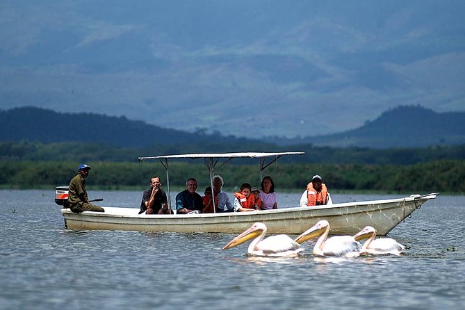
The lake has ebbed and flowed over the years, as the half-submerged fencing posts indicate. Early in the 1890s, it dried up almost completely, but then it rose a phenomenal 15 metres and inundated a far larger area than it presently occupies. It has receded since then and currently covers about 170 sq km. Since it is a freshwater lake that can be used for irrigation purposes, the surrounding countryside is a major production area for fresh fruit and vegetables, as well as beef cattle, both for domestic consumption and export. There’s even a vineyard on the eastern shore.
On the western side of Lake Naivasha, past the village of Kongoni, there is a crater lake with lush vegetation at the bottom of a beautiful but small volcanic crater. If you have transport, it’s worth visiting. South of the lake is Hell’s Gate National Park, which is well worth exploring and is one of the few national parks in which you’re allowed to walk. On the eastern side of the lake is Crescent Island, a bird sanctuary that you can visit by boat.
Between 1937 and 1950, Lake Naivasha was Nairobi’s airport! Imperial Airways and then BOAC flew Empire and Solent flying boats here on the four-day journey from Southampton. Passengers came ashore at the Lake Naivasha Hotel, where buses would be waiting to shuttle them to Nairobi. The lake also featured strongly among the decadent Happy Valley settler crowd in the ’30s. The mansion known as Oserian (or the Djinn Palace), which features in the book (and the dreadful movie) White Mischief, is on the southern shore of the lake. It’s privately owned and is not open to the public. For a full account of the history of European activity in the area, get hold of a copy of Naivasha & the Lake Hotel by Jan Hemsing, available from the Lake Naivasha Hotel.
Hell’s Gate National Park
This park is one of only two parks in the country that you can walk through (the other is Saiwa Swamp near Kitale). The looming cliffs and Hell’s Gate Gorge itself are spectacular and are home to a wide variety of bird and animal life. On a walk through the park, it is possible to see zebra, Thomson’s gazelle, antelope, baboon, and even the occasional cheetah or leopard. Ostriches and the rare lammergeier are also sighted on occasion.
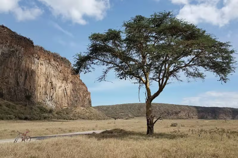
The usual access point is through the main Elsa Gate, two km from Moi South Lake Road. From here, the road takes you past Fischer’s Tower, a 25-metre-high column of volcanic rock named after Gustav Fischer, a German explorer who reached here in 1883. He had been commissioned by the Hamburg Geographical Society to find a route from Mombasa to Lake Victoria, but this was about as far as he got, largely because he was unable to get on good terms with the hostile Maasai.
The road then continues through the steep-sided gorge and emerges at the Olkaria Geothermal Station, a power project that utilises one of the hottest sources in the world. You can see the plumes of steam rising into the air from many of the viewpoints in the park. To the left of here, you’ll see Central Tower, another column of volcanic rock similar to Fischer’s Tower but much larger.
From the geothermal plant, the track heads back to the lakeshore via the Olkaria Gate and emerges in the vicinity of Oserian Farm (now a large supplier of cut flowers, fruit and vegetables to the European market) and Elsamere. The entire walk from the lake road turn-off via Elsa Gate and Olkaria Gate to the lakeshore is 22 km. The distance between the two gates via the lake road is nine km. If you intend to walk the whole way through the park (and it’s well worth doing so), allow a full day and take along some drinking water and something to eat. The usual park entry and camping fees apply. If you don’t want to walk through the park, it may be possible to arrange a trip by car if you ask around in Nairobi.
Lake Elmenteita
Like Lake Nakuru, Elmenteita is a shallow, soda lake with a similar ecology. Flamingos live here too, but in nowhere near the same numbers as at Nakuru. Elmenteita is not a national park, so you can walk around it and there are no entry fees. However, there are few tracks and, as most of the shoreline is privately owned, there’s a lot of fencing. We recently had a letter from a woman traveller who attempted to walk around the lake alone and she was not at all impressed by the absence of a warning about how difficult it was. Think twice before attempting it!
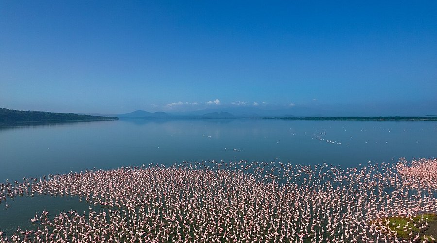
The easiest way to get there is to take a matatu along the Naivasha to Nakuru road and get off at one of the signposted viewpoints on the escarpment above the lake. You can either walk down from there or hitch a ride.
Lake Nakuru National Park
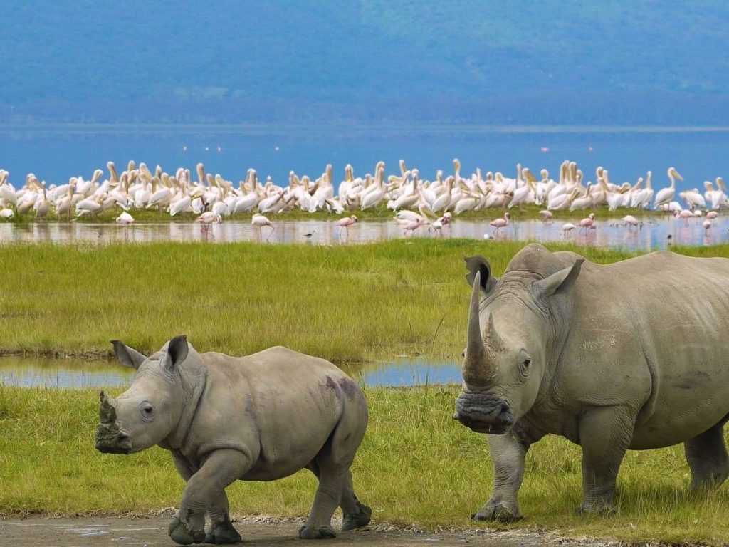
Created in 1961, the park has since been considerably increased in size and now covers an area of some 200 sq km. Like most of the other Rift Valley lakes, it is a shallow soda lake. Some years ago the level of the lake rose, and this resulted in a mass migration of the flamingos to other Rift Valley lakes, principally Bogoria, Magadi and Natron. What had been dubbed ‘the world’s greatest ornithological spectacle’ suddenly wasn’t anywhere near as spectacular. Since then the lake has receded, and the flamingos have returned, once again giving you the opportunity to see up to two million flamingos along with tens of thousands of other birds. It’s an ornithologists’ paradise and one of the world’s most magnificent sights. Those of you who have seen the film Out of Africa, and remember the footage of the flight over the vast flocks of flamingos, are in for a very similar treat. Simply go up to the lookout on the top of Baboon Cliffs on the western side of the lake and feast your eyes on the endless pink masses which fringe the lake.
Don’t blame us, though, if the birds are not there in such profusion or even if the lake dries up! The flamingos migrate from time to time if food gets scarce and there’s a better supply elsewhere — usually to Lake Bogoria further north or to lakes Magadi and Natron further south.
The lake is very shallow and the level fluctuates by up to four metres annually. When the water is low the soda crystallises out along the shoreline as a blinding white band of powder which is going to severely test your skills as a photographer. Lake Nakuru last dried up in the late 1950s and, at that time, soda dust storms and dust devils whipped up by high winds made life unbearable for people in the town and surrounding area. In the dry season, you’ll see these dust devils (like tiny tornadoes) whipping soda up into the air as they course along the shoreline.
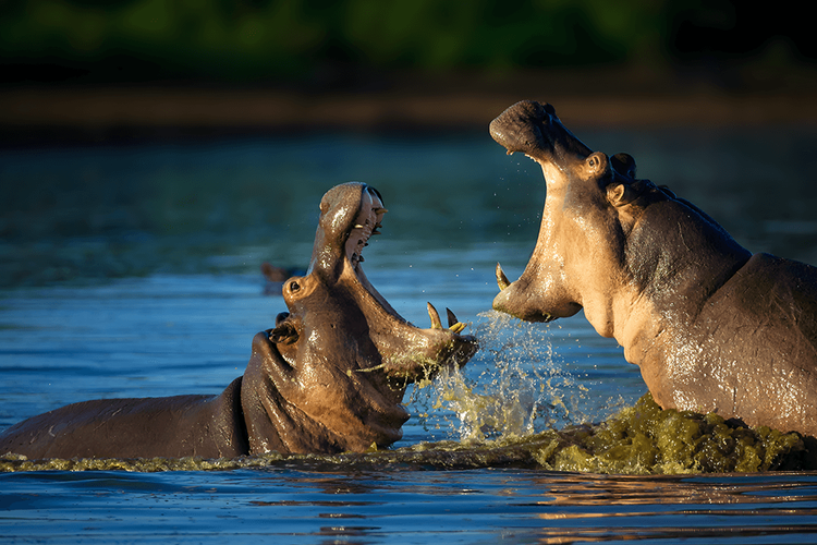
Since the park also has areas of grassland, bush, forest and rocky cliffs there are many other animals to be seen apart from birds. One species you’ll see plenty of the warthogs with their amusing way of running with their tails erect. Right by the water, you’ll come across waterbuck and buffalo, while further into the bush are Thomson’s gazelle and reedbuck — there’s even the occasional leopard. Around the cliffs, you may catch sight of hyrax and birds of prey. There’s even a small herd of hippos which generally lives along the northern shore of the lake.
The national park entrance is about six km from the centre of Nakuru. The usual park entry fees apply. As in most national parks, you must be in a vehicle. Walking is not permitted so you will either have to hitch a ride with other tourists, rent your own vehicle or go on a tour. You can only get out of your vehicle on the lake shore and at certain viewpoints. It’s a memorable experience being in the proximity of several hundred thousand flamingos feeding, preening, grunting and honking and even more memorable when several thousand of them decide that you’re a little too close for comfort and they take off to find a more congenial spot.
Menengai Crater
Rising up on the northern side of Nakuru is the Menengai Crater, an extinct 2490-metre high volcano. The crater itself descends to a maximum depth of 483 metres below the rim. You can drive right up to the edge, where there’s one of those totally trivial signs telling you that you’re five million km from some city halfway across the world.
To walk up to the crater takes a solid couple of hours, and it really is up, but still a very pleasant walk. The views back over Lake Nakuru are excellent, as are the views north to Lake Bogoria once you reach the top. About three-quarters of the way along there is a small group of facilities where you can get basic meals, soft drinks and, of course, the amber fluid. The usual park entry fees apply.
Hyrax Hill Prehistoric Site
Just outside Nakuru on the Nairobi road, this prehistoric site is open daily with usual park entry fees. Archaeological excavations were first conducted here in 1937 although the significance of the site had been suspected by Louis Leakey since 1926. Further excavations have been conducted periodically, right up into the 1980s.
The finds at the site indicate three settlements were made here, the earliest possibly 3000 years ago, the most recent only 200 to 300 years ago. From the museum at the northern end, you can take a short stroll around the site, starting with the North-East Village where 13 enclosures or pits were excavated. Only Pit D, investigated in 1965, is still open; the others have grown over. The North-East Village is believed to be about 400 years old, dated by comparison with the nearby Lanet site. A great number of pottery fragments were found at the site, some of which have been pieced together into complete jars and are displayed in the museum.
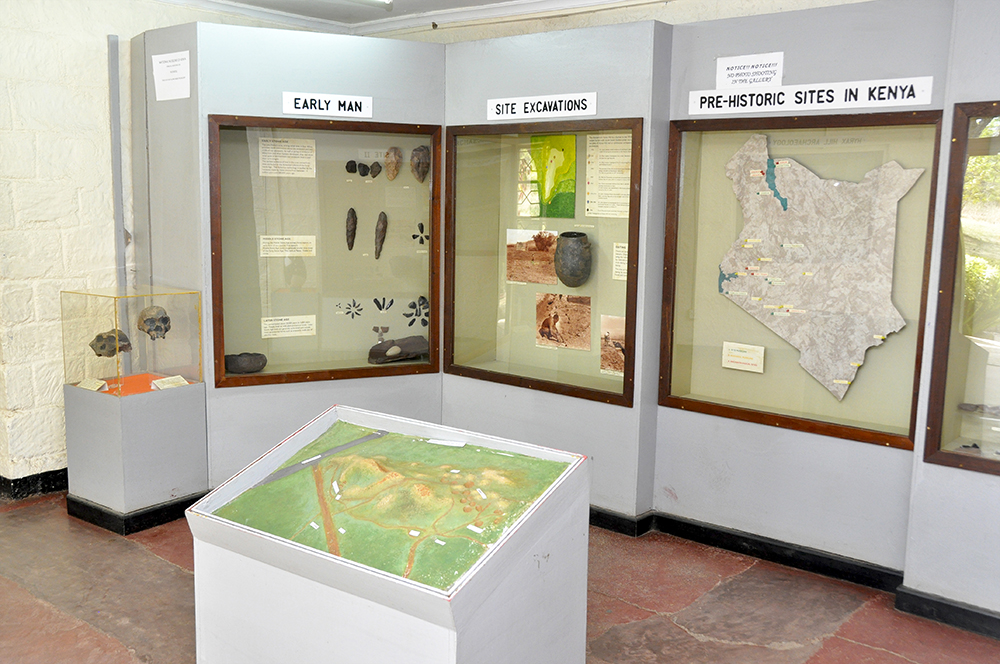
From the village, the trail climbs to the scant remains of the stone-walled hill fort near the top of Hyrax Hill, which gave the site its name. You can continue up to the peak from where there is a fine view of the flamingo-lined Lake Nakuru.
Descending from the hill on the other side you come to the Iron Age settlement where the position of Hut B and Hut C is clearly visible. Just north of these huts, a series of burial pits containing 19 skeletons was found. Since they were mostly male, and a number of them had been decapitated, it’s possible they were killed in sort sort of fighting. Unfortunately, souvenir seekers have stolen the bones that were displayed.
Virtually underneath the Iron Age site, a Neolithic site was discovered. The Iron Age burial pits actually topped a Neolithic burial mound and a second Neolithic burial mound was found nearby. This mound is fenced off as a display. Between the burial mound and the Nairobi road are more Iron Age pits, excavated in 1974. The large collection of items found in these pits included a real puzzle — six Indian coins, one of them 500 years old, two of them dating from 1918 and 1919! Finally, following the path back to the museum, there’s a bau board in a large rock. This popular game is played throughout East Africa. You are free to walk around the site yourself but a guide is useful. He’ll expect a small tip at the end.
Nyahururu & Thomson’s Falls
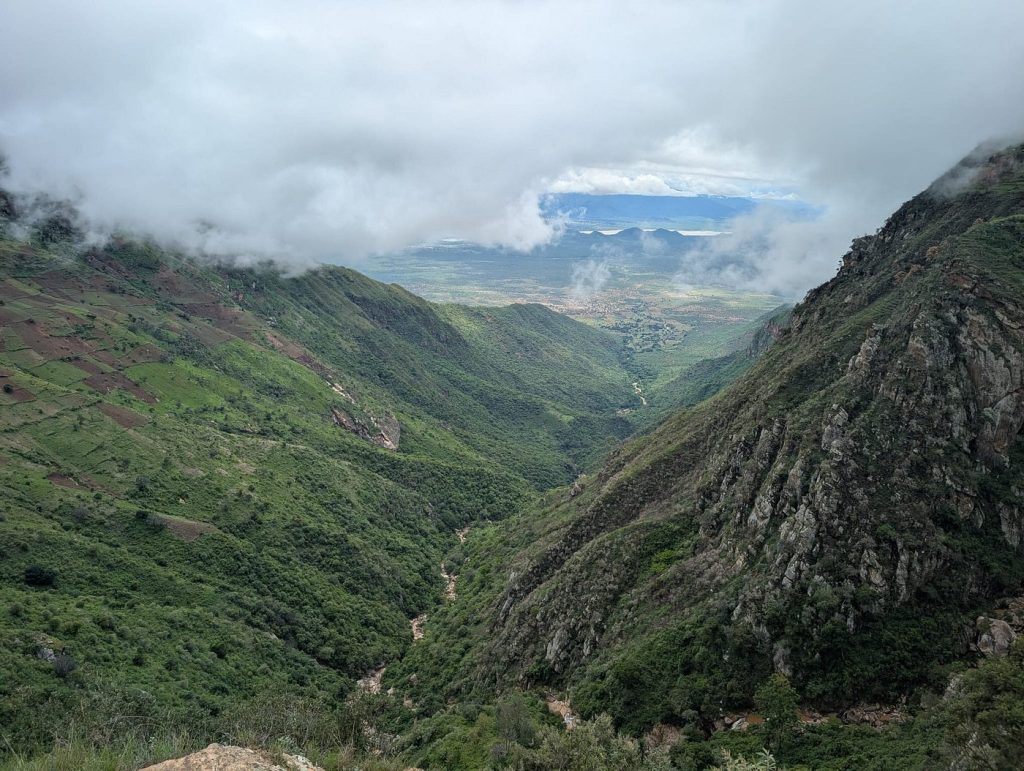
Nyahururu, or ‘T Falls’ as virtually everyone calls it, was one of the last White settler towns to be established during the colonial era and didn’t really take off until the arrival of the railway spur from Gilgil (on the main Nairobi-to-Kisumu line) in 1929. The railway still operates, but these days it carries only freight. Nyahururu is one of the highest towns in Kenya, at 2,360 metres, and the climate is cool and invigorating. The surrounding undulating plateau is intensively cultivated with maize, beans and sweet potatoes and is well forested, mainly with conifers. The most interesting approach to the town is probably along the excellent road from Nakuru, which snakes up and down through farmlands and forests and offers some spectacular views over the Aberdares.
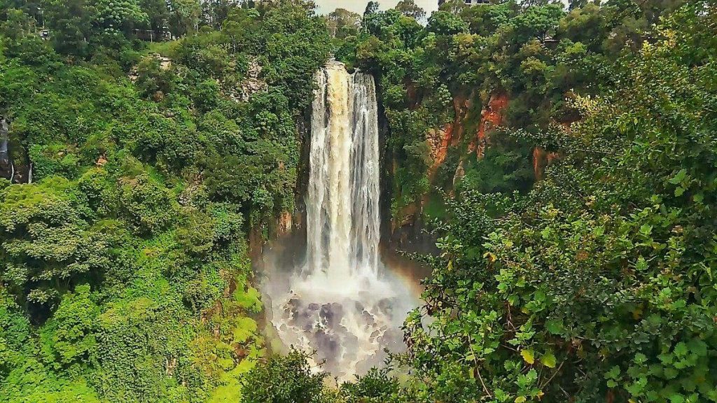
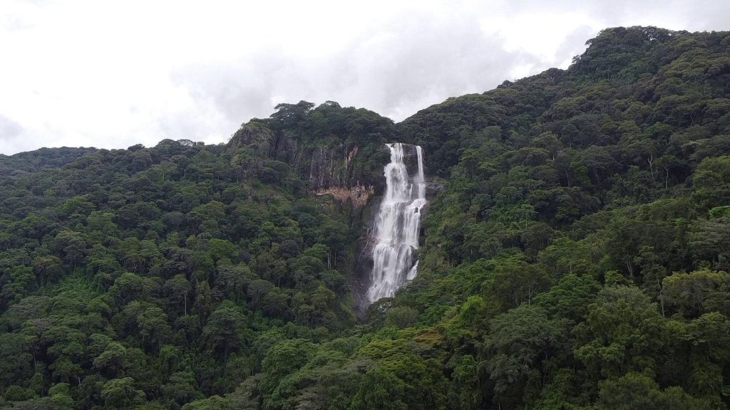
The falls, on the outskirts of town, are named after Joseph Thomson, who was the first European to walk from Mombasa to Lake Victoria in the early 1880s. They’re a popular stopover for safari companies en route to Maralal and points further north, and are well worth a visit. Formed by the waters of the Ewaso Narok River, the falls plummet over 72 metres into a ravine, and the resulting spray bathes the dense forest below in a perpetual mist. A series of stone steps leads down to the bottom of the ravine and provides the only safe access. Don’t attempt to go down any other way, as the rocks on the side of the ravine are often very loose. Up above the falls and partially overlooking them (though the view is obscured by a row of ugly souvenir shacks) is the old colonial watering hole, Thomson’s Falls Lodge, which has retained much of its quaint atmosphere and is still the most interesting place to stay. The hotel grounds are a popular place for a Sunday picnic with local families. There’s supposedly a US$30 charge for using the hotel grounds if you’re not staying there, but this is rarely enforced.